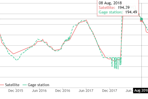
Reservoir monitoring
AQUACHANGE uses measurments from gage stations and measurments from Satellite, to estimate reservoir water level. Compare the result of the two measurments.
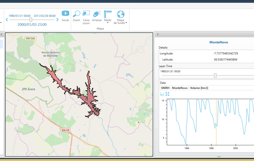
Reservoir forecasting
AQUACHANGE integrates numerical models providing forecasts on river water flows which allow to estimate affluent water to reservoirs. This monitoring and forecast capabilities can also be operationally integrated with other platforms/databases.
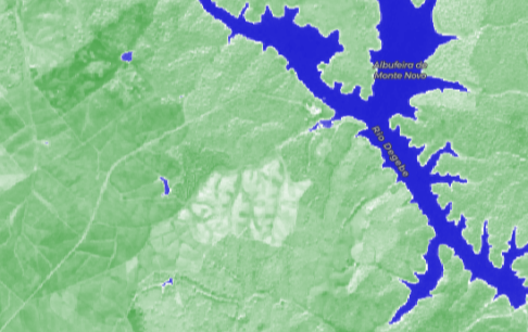
Reservoir Surface Water
Satellite images provide a direct measure of the reservoir surface water extent. Compare two images showing changes in surface water between 2018 and 2019 in Monte Novo Reservoir.
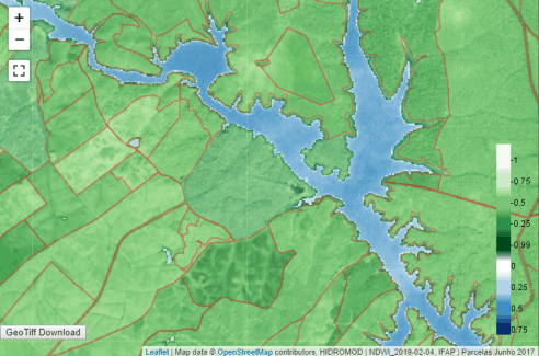
Satellite data
The Normalized Difference Water Index (NDWI) index measures surface water. AQUACHANGE produces NDWI based on Sentinel2 satelite image. Access our WMS that keeps you updated on reservoir surface water changes. Download the GeoTiff!